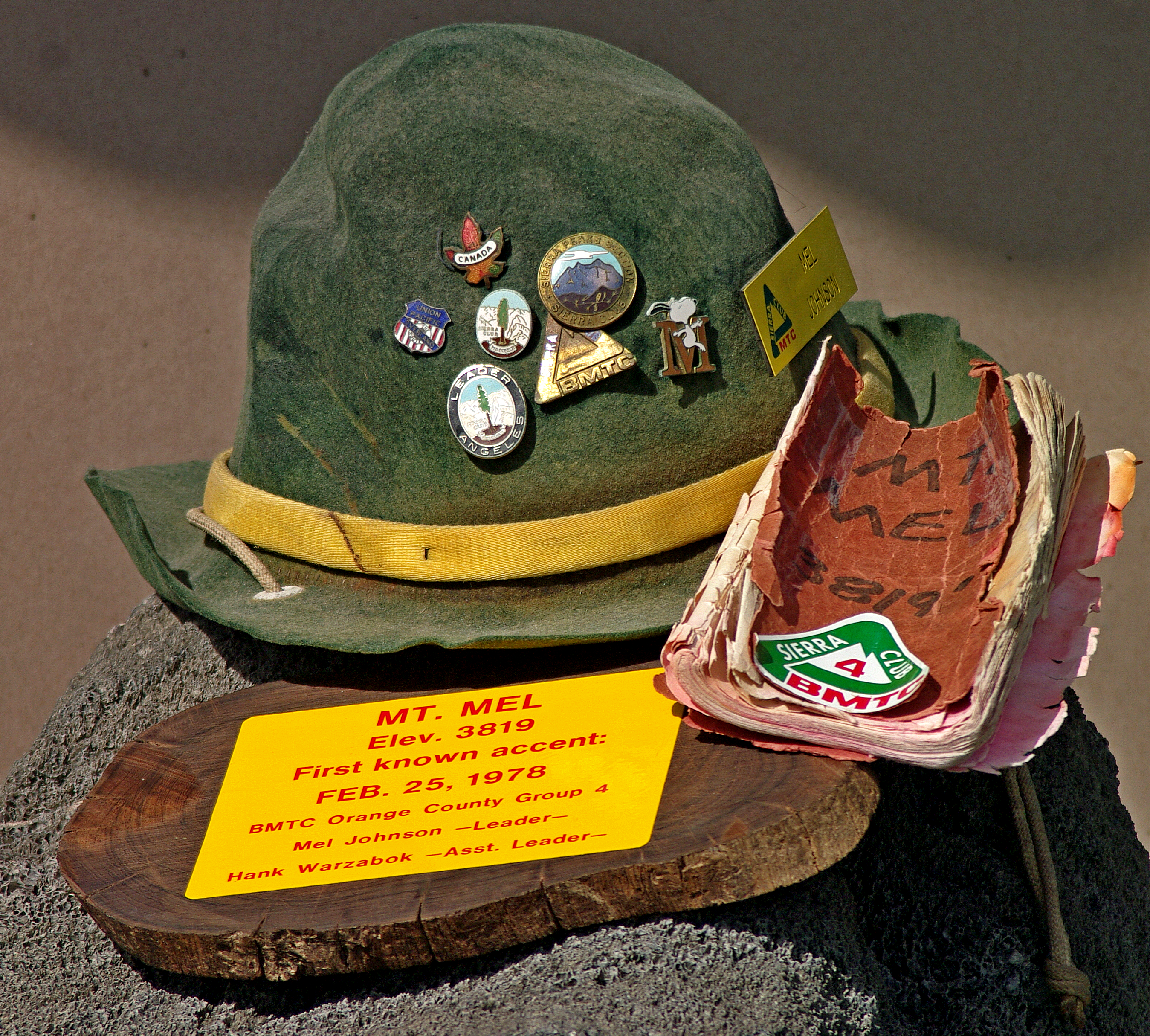
Recently, as I was wondering around the Internet, for some reason, I entered the search term “Mt. Mel”. Much to my surprise, a U-Tube page was returned which showed a peak, alleged to be “Mt. Mel”, which I recognized as the minor hill in Joshua Tree National Park which we used as a training site for the Sierra Club’s “Basic Mountaineering Training Course”. I was the leader of “group 4” and I had earlier selected this small hill as the destination point of a day-long hike during which we taught the twenty students of “group 4” the basics of field navigation using the Silva “boy scout compass” and a 15 minute series topographical map. The selection was based on the easily identified shape of the map’s contour lines representing the small hill. The shape is perceived as a group of concentric circles that is consistent with the conical appearance of the hill when viewed from a distance. It was our practice to ascend the hill and use the vantage point of the summit to practice the art of “reading” a map. After lunch on the summit, the students were instructed to use their new navigation skills to return to the base-camp. We did this for nine years running as I recall.
For reasons long since forgotten, the assistant leaders of “group 4” conspired to surprise me by springing a champagne fueled ceremony, before lunch, during which the small hill was named “Mt. Mel”. A suitably marked canister was left on the summitwhich contained a small book for future climbers to leave their mark. The event unfolded February 26, 1976. Years later, this book was recovered by one of my assistant leaders and given to me as a memento of a fondly remembered period of my life. The last entry in the book is dated October 23, 1993. Later, the “group 4” leaders became known as the “Sierra Turkeys” and then the “Denali Turkeys”, as our climbing trips became more ambitious. But, that is another story.


I’d like to visit Mt. Mel sometime!
John,
Me too!
The Old Machinist